Notice to Mariners
APPROACH INFORMATION FOR VISITING VESSELS!
Due to increased siltation, there is reduced water depth available at Harbour entrance. Vessels over 2 mtr draft should contact the Harbour office for entering advice.
Harbour Duty Mobile 07889081860
Portrush Harbour Admiralty Chart
Lat 55 13’ N; Long 6 40’ W.
Admiralty Chart: 2494
Admiralty Pilot: 40
Time Zone: GMT
UNCTAD Locode: GBLDY-0014
Authority:
Portrush Harbour, Harbour Office, Portrush, BT56 8DF, Co Antrim Tel: Duty Mobile 07889081860
Harbour Master: Mr Beni Mc Allister
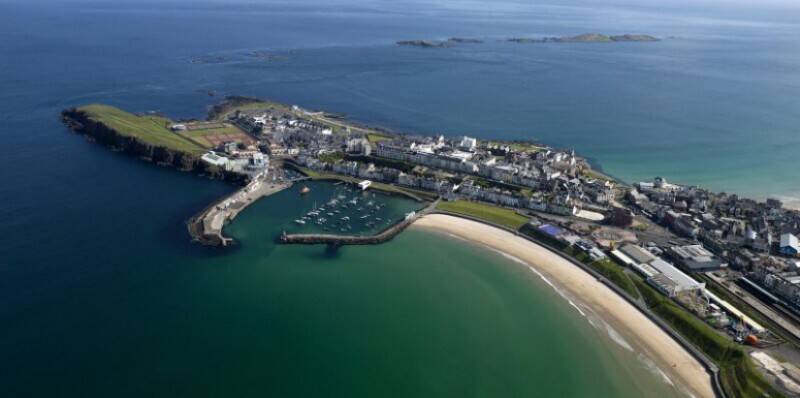
Approach: CAUTION! Due to siltation reduced water depth available at Harbour entrance. Vessels over 2 mtr draft should contact the Harbour office for entering advice.
Leading marks bearing 028 degrees, fixed blue at night, two orange triangular shapes by day. Vessels should not get S of leading marks as water shallows quickly, as you get close to the beach.
At MLWS, sand bar just outside of entrance.
Max depth of 3 m
Anchorage:
0.5 mile W of North Pier. Not suitable in strong W or NW winds. Note: When anchoring it is advised to check Admiralty chart for location of undersea cable west of the harbour. Ensure to keep clear of Harbour entrance.
Radio frequency:
VHF Channel 12
Weather:
W or NW winds above force five can cause breaking seas across the harbour entrance
Tides:
range of tide (springs) 2 m
Largest vessel: 20 mtrs length x 2.0 mtrs draft
Waste reception facilities:
General and recyclable waste receptacles available on the quayside.
Waste oil received - Please contact the Harbour office for guidance.
Portrush, 0.25 mile